The Chinese New Year began on Monday, February 8th, which was yesterday. Sorry; I should have posted an announcement on Sunday so people could have planned parties and what-not.
This is the Year of the Monkey, but not just any monkey. No, this is the Year of the Fire Monkey. Chinese culture has it’s own zodiac and animals of the zodiac. Not only are twelve animals supported in this zodiac but one of 5 Essential Elements is paired with each zodiac providing 60 unique combinations. From what I understand there is another set of additional zodiac modifiers that provide an influence on a 60-year cycle.
If you’d like more interesting details, here is a good web site: China Highlights
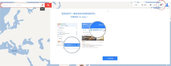
Interestingly enough, China has a Street View like web-based map available. See, Google Maps and Google Street View are banned from China. Over the winter break I had an opportunity to sit down with a Chinese student. Xiaoling (“shaw-ling”) and I sat and used Google Maps to inspect her neighborhood in China. Then, we used Google Maps to inspect some areas in Murray, KY. “Of course, the Chinese government would never allow this in China,” I stated. “Oh no!” Xiaoling agreed. And, then I walk into a fellow professor’s office to wish her Happy New Year (Xin Nian Kaui Le, sort of like “shin knee-ahn kw-eye luh“) and she is looking at maps.baidu.com and is looking at essentially what is Google Street View, but the Chinese version of Street View.
 Then, and this is where knowing a little bit about geography helps, find a city to zoom down to. Like Shanghai. Beijing. Pudong. Guangzhou. Those are all fine options. Dig out your geography book, turn to the East Asia chapter, and find a good place. Dismiss the How-To screen and zoom in on some place.
Once you’ve selected some bit of Chinese geography, and begin to zoom in, as the scale becomes larger more and more streets will appear. Don’t worry about the Chinese characters; that is not the point of this exercise. Just zoom down to a comfortable level of detail (below).

Once you’re down to a particular neighborhood stop zooming and click the picture in the lower-right corner (the red box in my example). When the picture is clicked, the roads will become blotted by heavy blue lines. This symbology indicates the road has been captured by a roving camera-car. Move your cursor over the blue lined-roads and a little one-eyed robot will appear. Choose one of the roads by clicking on the road. Try to find a place where the road density is thick. Interesting stuff tends to be where the road network is more dense.
The view will spin and rotate and dissolve and then resolve into a street level view of whichever city street you selected. By clicking the street arrows you can move forward or backward. If you click-drag your mouse on the screen, the view will rotate in that direction. If your screen is touch-sensitive you might be able to swipe left or right to accomplish the same thing.
Zipping along the city streets one can get a sense that some cities in China don’t seem all that different from cities in the United States. Many recognizable makes and models of cars. Modern buildings. Nicely landscaped boulevards. Only when we turn to look at buildings and see the Chinese characters do we get a hint we aren’t in Kansas. Or Louisville.
Yes, China DOES have its own version of Google Street View and it is pretty cool. PAX.
